July 5-6, 2002
Rob Jagnow and Kevin Lohner
|
Leaving town on the evening of July 4, I was treated to every firework show from San Francisco to Livermore. It would have been nice to stay around for the evening, but according to MapQuest, I had an 11-hour drive ahead of me, and Kevin and I had planned to meet at the trailhead the following day at noon. The late-night roads were all but abandoned, so driving went substantially faster than anticipated. After passing by a long string of full campsites, I finally settled in at the Oh! Ridge Campground near June Lake around 2:30am, reserving 100 miles of driving for the following day. As is typical in a family campground, I woke around 7:30 to the sounds of shouting children lacking all early-morning discretion. It was nice to get my first glimpse of June Lake and the surrounding mountains, which had been completely invisible in the moonless night. I left around 8:30, stopping for a quick breakfast in Bishop at a little internet cafe that was suggested by a hitchhiker I picked up. |
|

|
I arrived at the Ranger's Station in Lone Pine at 11am, just a few minutes after Kevin. Obtaining the required permits for the trip was surprisingly painless, and we were soon on our way out of Lone Pine, heading toward Whitney Portal - the trailhead for Whitney, Russell, and a number of other peaks in the area. |
|

|
|
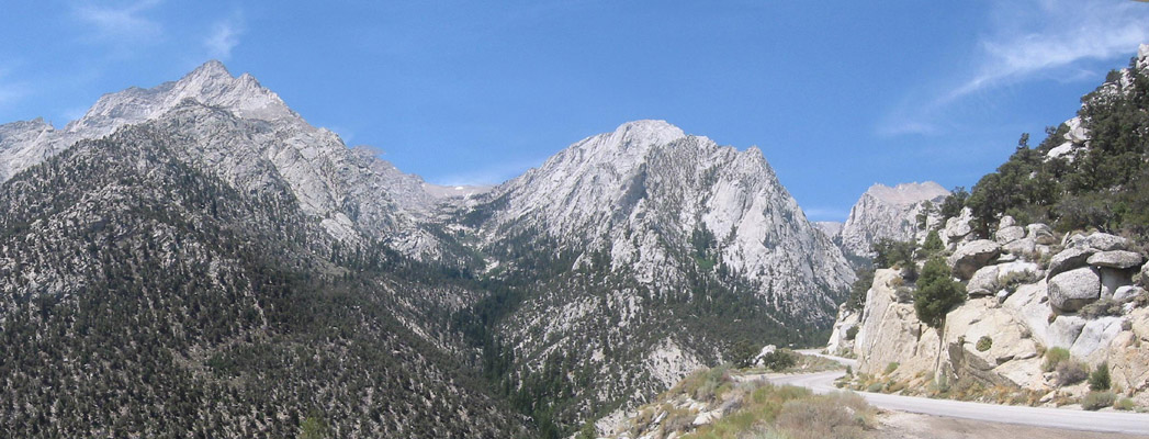
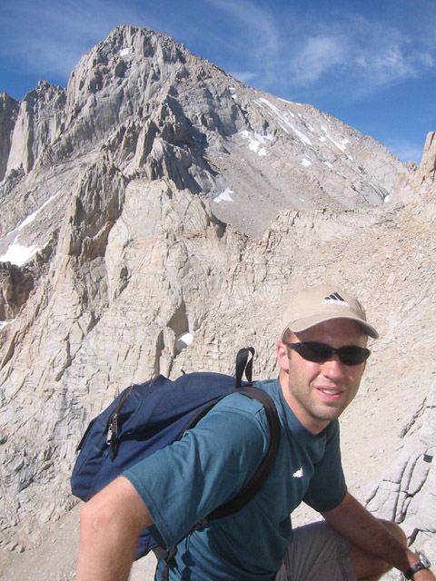
Kevin and I opted to stay away from Whitney to avoid the crowds that frequent this relatively accessible summit, hailed as the highest point in the continental United States. Russell, right next door at 14,088 ft., is less accessible due to an exposed Class 3 traverse along a knife-edge ridge. We started our hike around 1pm from the crowded Whitney Portal parking lot. Within 20 minutes, we reached the turnoff from the main Mt. Whitney trail to the Mt. Russell trail, happily leaving the crowds behind us. The remainder of the day was spent hiking toward Upper Boy Scout Lake at 11,350 ft. The trail was poorly maintained, and we were often haunted by the thought that we had lost it alltogether. Cairns were infrequent at best, so navigation required a lot of bushwhacking and backtracking. |
|
|


|
|
|


|
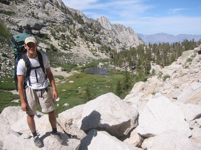
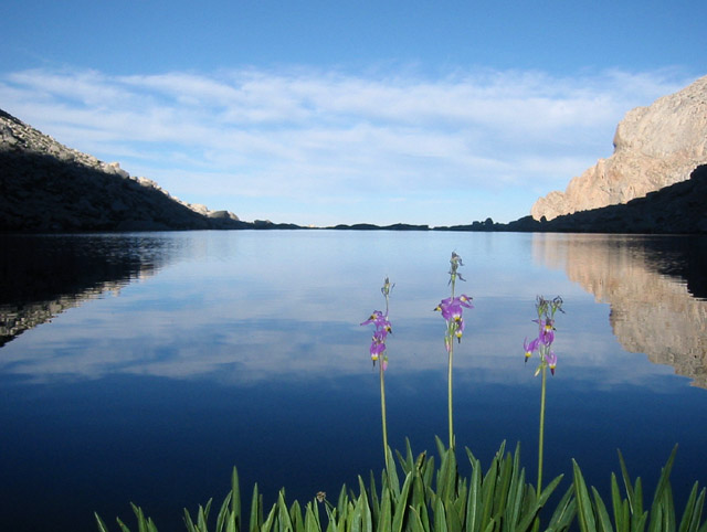
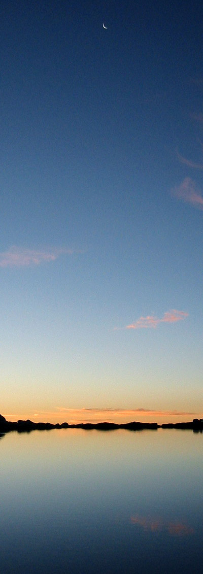
When we finally reached the east end of Upper Boy Scout Lake around 5pm, we considered hiking another half mile to the next lake up the mountainside to get a jump-start on the following day's hiking. But by the time we had circled around to the west end of the lake, the high-altitude exhaustion had defeated us, so we settled in for the night on the west shore. The view from the campsite was stunning. From the grassy shore, the scene was composed of the crystal clear lake with a perfectly reflected sky, separated only by a thin finger of land that formed the dam on the east end. The view was strangely surreal and we shot dozens of photos as we waited for the sun to set. The ample fish population put on a good show, often jumping entirely out of the water, as if for purposes of pure entertainment. |
|
|
|


|
|
| ||||||
|
|


|
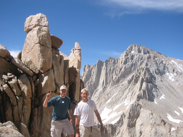
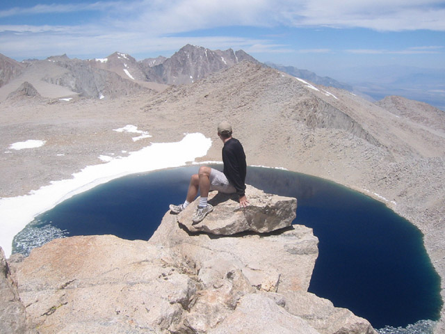
After a restless night's sleep, we woke before sunrise feeling much more acclimated than the night before. We left our bulky gear at the campsite, taking only what we needed for the day hike. We soon passed the next lake up the mountain, which, as it turns out, was a murky little puddle that would have made for a lousy campsite. At this point, the trail turned from boulder-hopping to vast, steep talus slopes on all sides of the valley. Where the talus ended, we were faced with a steep stone face on the north side of the canyon, with no indicators as to where a navigable route might be found. After several unsuccessful attempts at climbing the wall, we finally found a route up to the top, where we were presented with an even more expansive talus slope, which rose nearly 2000 ft. to the saddle between Mt. Russell and Mt. Carillon. Climbing was a slow, tedious process of jogging up the scree slope, one small section at a time, hopping from boulder to boulder in a search for stable terrain. Kevin and I took different routes to reduce the chance of rockfall injury. We topped out at the saddle around 10:30am and were greeted with more stunning views. To the north, we could see the dark blue Tulainyo Lake, the highest lake in the continental United States. To our east was Mt. Carillon. To our west, the knife-edge ridge leading to the twin summits of Mt. Russell. |
|
|
|


|
|
|


|
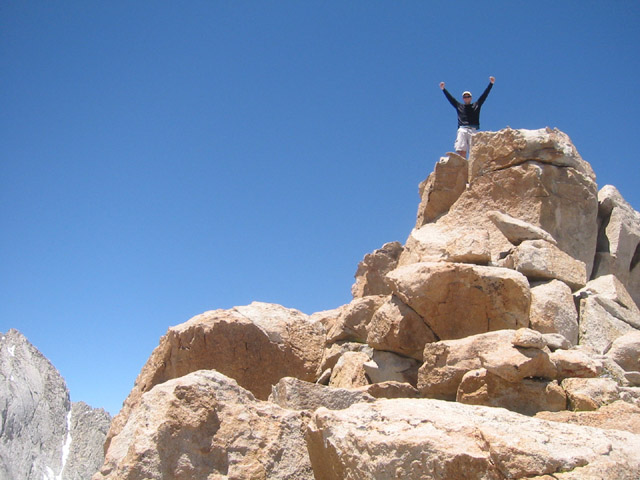
We left one of our bags at the saddle, packing our bare essentials into the other. The ridge traverse to Mt. Russell was remarkably exposed, with a 2000 foot drop on either side of the trail. Although the climbing wasn't technically difficult, the exposure was rather intimidating. About half way to the east summit of Mt. Russell, Kevin opted not to complete the traverse. The climbing had become increasingly difficult, and as I went forward, I shouted back a review that it wasn't getting any easier. While Kevin stayed back to rest, I took about 20 minutes to reach the summit and get some photos. We were short on time, and still hoped to climb Mt. Carillon, so I opted not to visit the west summit of Mt. Russell - the higher of the two. |
|

|
When I got back to Kevin, we backtracked east along the ridge, headed for Mt. Carillon at 13,552 ft. Although Mt. Carillon is also class three, it lacks the extreme exposure of Mt. Russell and proved to be an easy climb for both of us. We reached the summit shortly after noon and spent some time trying to rehydrate and eat. Kevin seemed relatively comfortable with the altitude. I could barely stomach half a banana. |
|
|
|
|
|


|
After a good rest, we retuned to the saddle and started our decent back to camp. Once again taking separate lines down the scree slopes, we opted to ski down the slope for a quick ride down. My shoes immediately filled with gravel, and had to be emptied repeatedly before making it down to the rocks below. We had been wise enough to mark our ascent route with a couple of cairns at critical locations, so we made it back to high camp without much difficulty. |
|
|
|


|
Back at camp, I packed up the tent while Kevin filtered enough water to make it back to Whitney Portal. We took a nice long break at Upper Boy Scout Lake, which looked remarkably different at midday. Somehow, the trip back down to Whitney Portal required even more backtracking and bushwhacking than the trip up. At times, we were sandwiched in a small box canyon no more than 50 feet from side to side, yet we still had trouble figuring out which path through the trees was the main trail. By the time we met back up with the main Whitney trail, we were wet, muddy, and bloody from pushing through the dense willow scrub. Finally back at the parking lot, we treated ourselves to pay showers and a big dinner at Carl's Jr. before the long drive back to our respective homes. I once again flew through Yosemite, completing Mapquest's 11-hour drive back to San Francisco in 6 hours and 10 minutes, leaving me a full four hours to sleep before crew practice the following morning. All in all, a successful trip. Unfortunately, with every weekend booked from now until the end of the summer, it will probably be the only California 14er I get a chance to visit this year. Next summer, Whitney. |
|
|


|
All images copyright 2002 by Rob Jagnow. |