On Wednesday, I hiked up to Caballo Mountain - one of the tallest visible peaks to the west of Los Alamos, with a large open pasture visible near the summit. I started at the Pajarito Ski Area at 10:20am. The trail begins at the entrance to Camp May where it traverses a ridge along the boundary of the Cerro Grande Fire's furthest extent. This is one of the few locations on the hike where the fire damage is evident. This trial soon opens into Ca�ada Bonita, a stunning meadow nestled between two hills that offers a view of Los Alamos to the east.
The trail continues along the valley to the west and then rises over the northern ridge, ultimately merging with the Quemazon Trail and Pipeline Road. Just beyond this intersection, I took Trail 282 north toward Cerro Rubio, a.k.a. Shell Mountain, noted by an outcrop of pinkish rocks near the summit. The trail eventually turns toward the east and the ridge narrows, eventually tapering to only a few feet across with a sharp drop-off at either side. Just before the ridge ends entirely, the well-maintained trail drops off the north side of the ridge, offering an easy descent from the cliff.
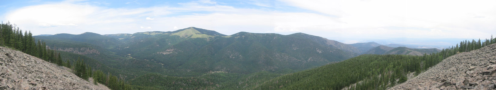
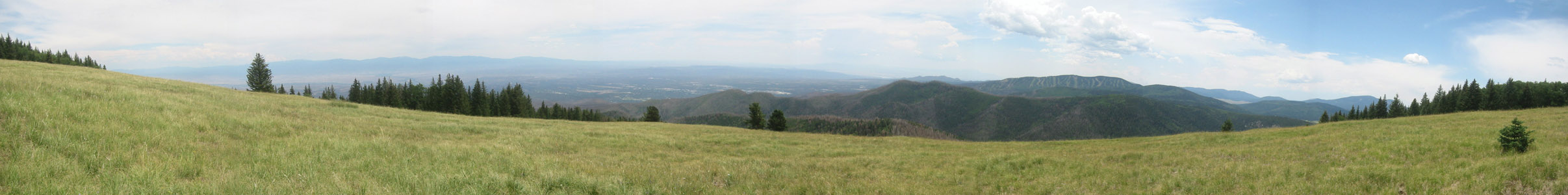
At the base of the canyon, the trail continued to the east past a series of quiet marshes, alive with butterflies. As I turned north onto Trail 277, the route became less maintained, but still easy to follow. Fallen trees and spurious animal trails occasionally made navigation more difficult, but it was always easy to find my way back to the right trail - marked by yellow or pink ribbons. The trail climbs the west face of the mountain, so the landmark meadow was not visible until the very summit. I emerged from the forest at 1:04pm, greeted with a spectacular 180-degree view from Espanola down to the Sandia Mountains.
The true summit isn't marked by a trail, but it's fairly easy to find through the sparse forest. It's definitely worth taking the trip to the north face of the mountain, which offers stunning views across Santa Clara Canyon and into Colorado.
After a quick hike to the top, I spent a full hour at the summit, taking photos and enjoying a light lunch. I started the descent at 2:05, sad to leave the views behind, but anxious to escape the approaching thunderstorms. By 3:30, the clouds had moved in and the thunder was all around me, so I made a quick jog back to the car, passing a number of hikers along the way. I arrived back at the parking lot at 4:35, making for a very quick 14-mile round trip. For others who may be planning the same route, it should be noted that I jogged much of the route, which should ordinarily be allotted a full 10 hours to hike.
|